Air quality baseline studies document air quality in a defined study area at and around a project site prior to project development. The study assesses the presence and quantity of particulate matter, metals, and other compounds.
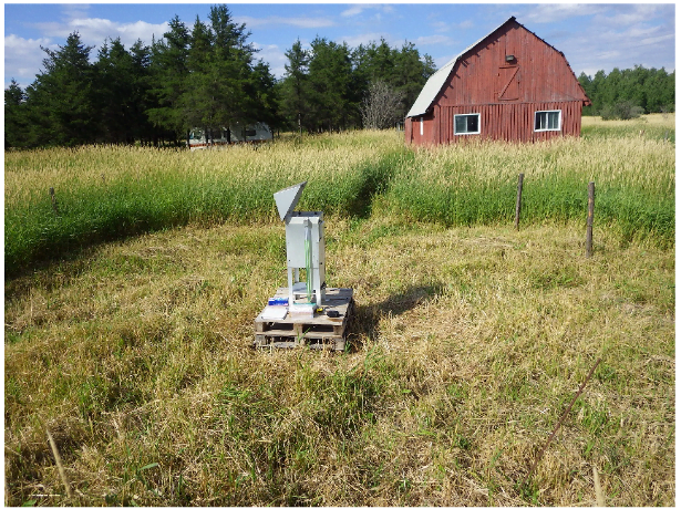
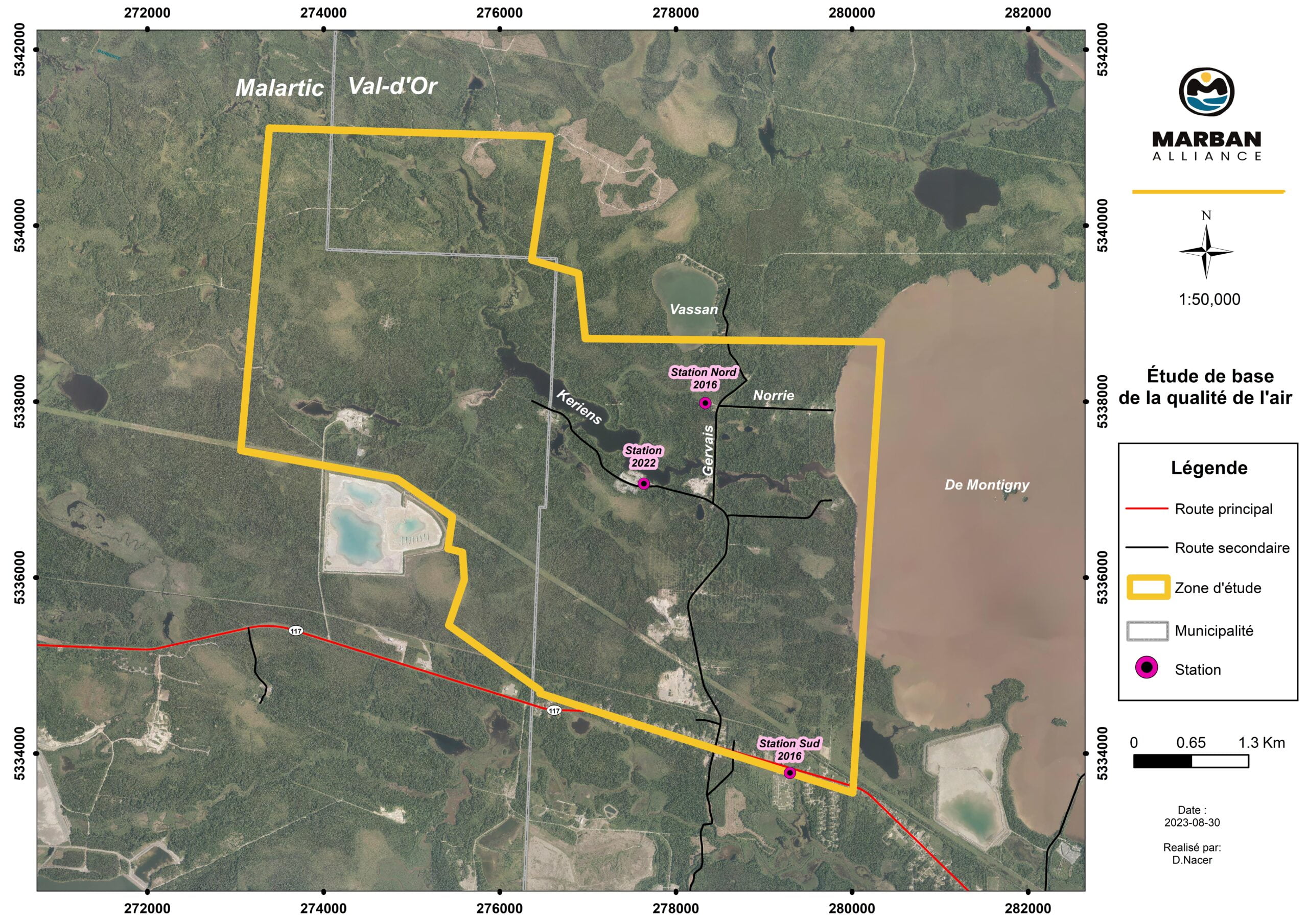
An air quality monitoring station is operated at the Project site to obtain first-hand information to obtain initial ambient air conditions. These data will be used to assess the project’s impact on air quality using atmospheric dispersion.
Characterization is carried out by sampling total suspended particulates (total particulate matter), metals in total particulate matter, fine particulate matter PM2.5 and finally, SO2, NO2 and O3 gases by passive sampling on adsorption cartridges. This sampling will be carried out using methods recognized by the MELCCFP, i.e. the High-Volt sampler (High-Volt) for total particulates and metals, and a low-flow
sampler (PQ-200) for fine particles.
Hydrology is the study of the earth’s surface water, especially its movement in relation to the land.
The main objective of this baseline study is to determine the hydrological and hydraulic properties of the watercourses in the study area.
The specific objectives of the study are to :

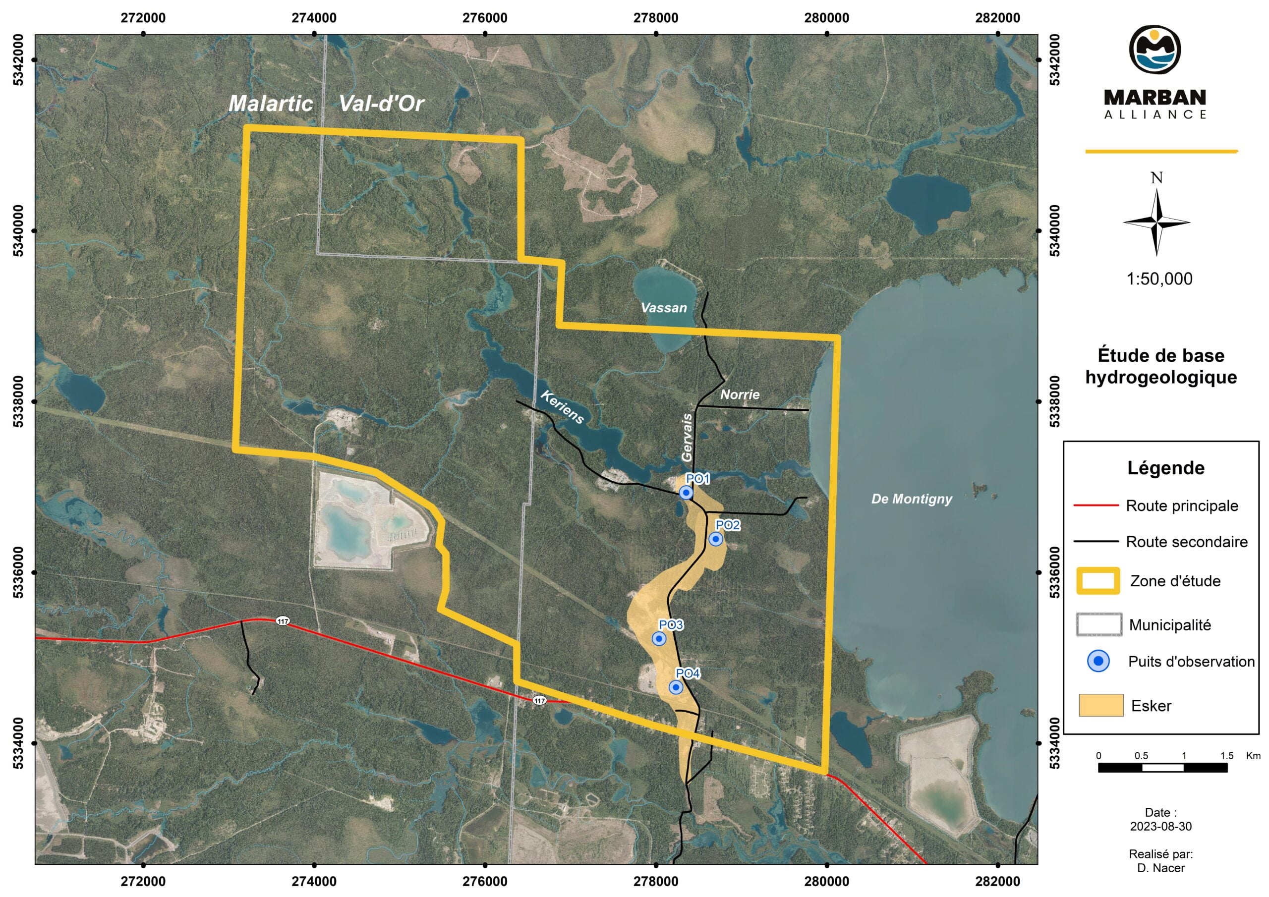
Hydrogeology refers to a part of geology that deals with the occurrence, distribution and effect of water beneath the ground surface (groundwater).
Hydrogeology baseline studies describe the current hydrogeological conditions in the study area. This includes determining how fast water flows through soil and rock, direction of flow, groundwater pressure and quality. These data will be used to do the hydrogeological modelling work to assess dewatering flows and anticipated groundwater drawdowns at the end of operations.
In addition to field data, various reference studies are used to establish the hydrogeological model :
The modeling work for this project includes the following steps :
The main objectives of the hydrogeological study are to:
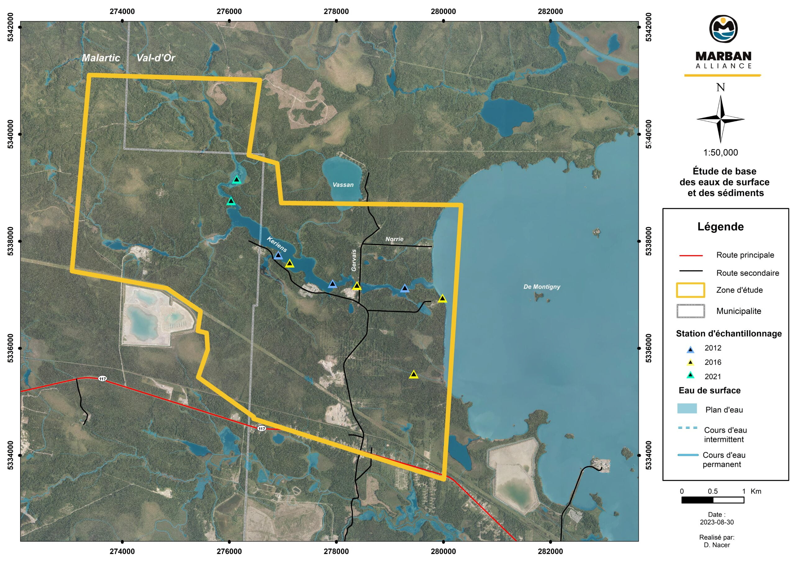
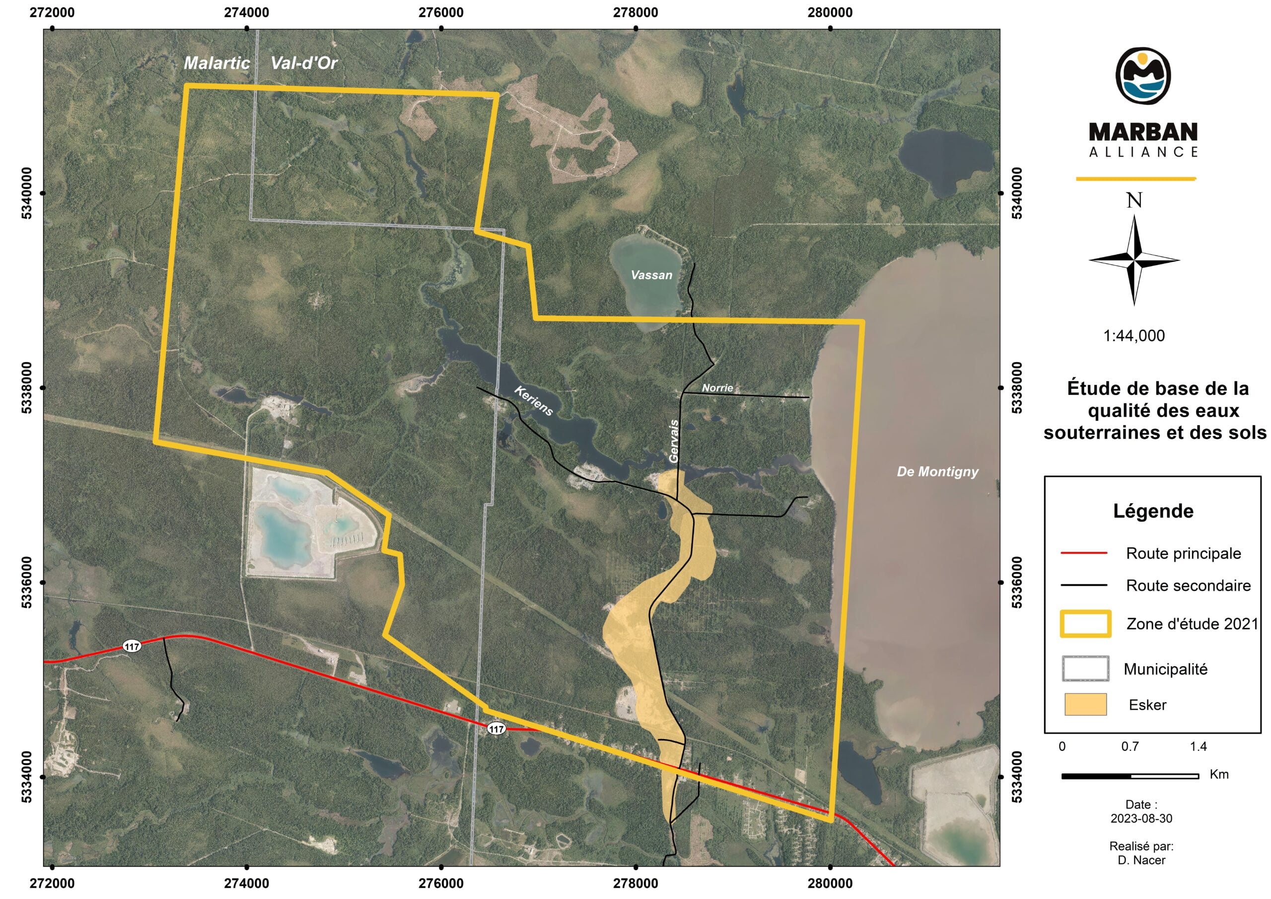
Surface water and sediments quality baseline studies is the characterization of surface water and sediment in nearby aquatic environments, prior to project implementation.
The specific objectives of this sector study are to:
The procedures for characterizing the baseline condition presented are the ones according to the Guide de caractérisation physicochimique de l’état initial du milieu aquatique avant l’implantation d’un projet industriel (MELCCFP, 2017).
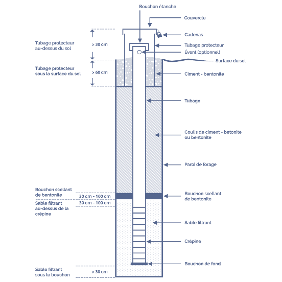
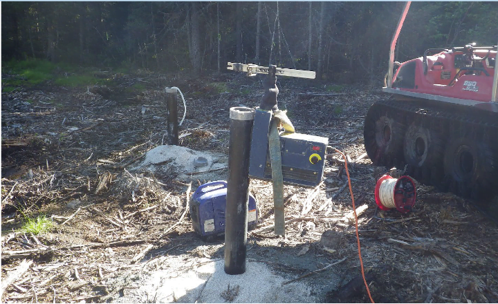
The basic study of groundwater and soil quality is carried out following a geotechnical drilling campaign to collect overburden cores and install observation wells in these boreholes. These observation wells, or piezometers, are tubes that allow access to groundwater from the surface, to read its level and sample it as required.
The groundwater baseline was determined using samples taken from wells installed on the site. Soil baseline conditions were established from samples taken at exploration trenches and boreholes on the study site. The method used to assess natural background levels (NBR) is based on the Lignes directrices sur l’évaluation des TDFN dans les sols (Ouellette, 2012) and the Guide de caractérisation physicochimique de l’état initial des sols avant l’implantation d’un projet industriel (MDDELCC, 2017).
Once the water and soil samples have been taken, they are submitted to a certified laboratory for analysis to obtain data on their physico-chemical quality.
In addition, soils are mapped according to their morphological, physical and chemical properties.
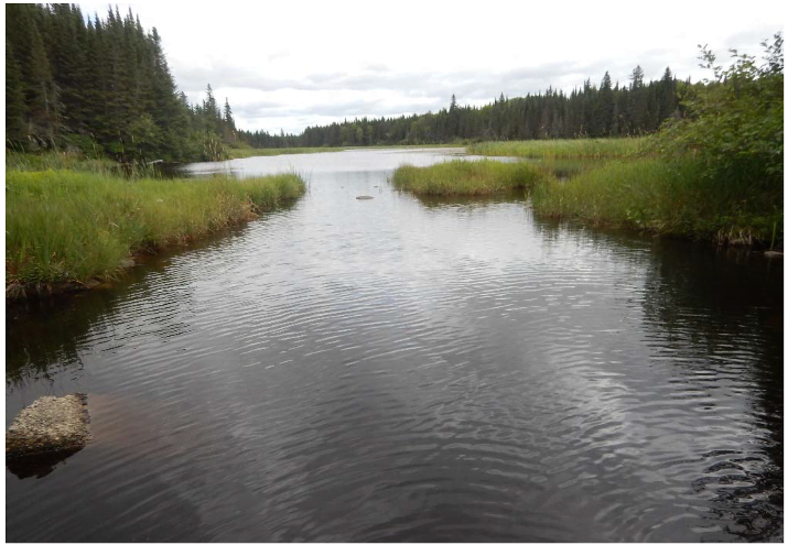
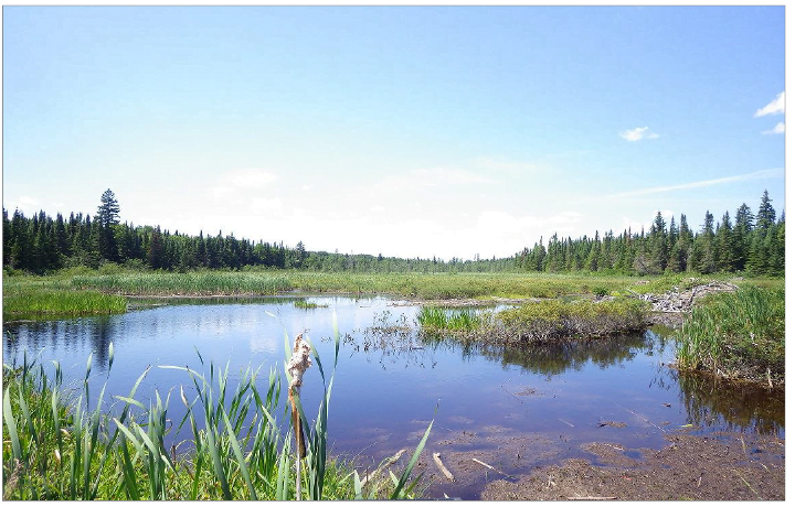
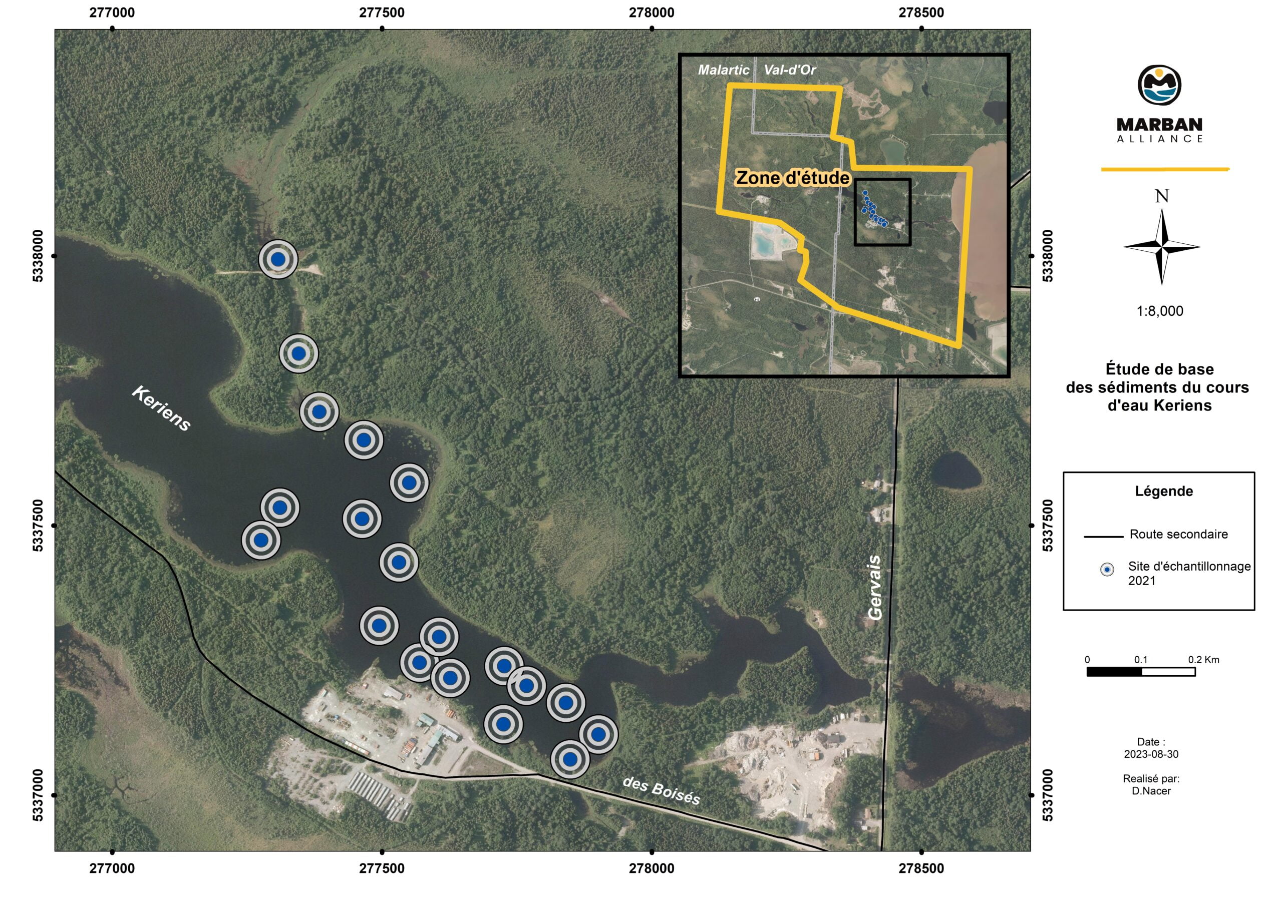
In anticipation of the upcoming environmental authorization procedure, a sediment quality characterization of the Keriens stream is being carried out. This characterization is required to establish the physico-chemical quality of sediments in the mining area.
The Marban Alliance project is partially located on the existing Keriens stream. The detour of the Keriens stream will result in the excavation of sediments, which will have to be managed in accordance with current guidelines.
Sediment characterization procedures are taken from the Guide d’échantillonnage des sédiments du Saint-Laurent pour les projets de dragage et de génie maritime (Environment Canada, 2002a), recognized as guidelines for sediment excavation or dredging projects also located outside the river by the Ministère de l’Environnement, de la Lutte contre les changements climatiques, de la Faune et des Parcs (MELCCFP).
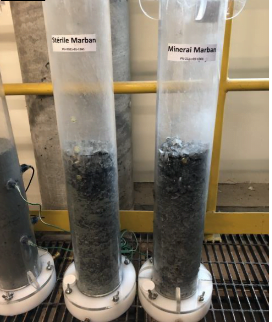
Geochemistry is the study of the chemical make-up of the Earth, rocks and minerals. Geochemical studies are important for predicting site water quality and possible treatment requirements as well as material management on surface in stockpiles. Static geochemical tests are carried out on mine waste rock from the Marban Alliance project deposit. The assessment of the acid-generating and leaching potential of mine waste rock from the proposed pit area is also performed in order to evaluate how these materials will be managed over the life of the operation. Kinetic tests are carried out to predict the environmental behavior of ore and waste rock from the Marban Alliance mining project. These tests are conducted at pH levels above neutrality (pH between 7 and 9) and leachates generated during rising are analyses according to the Directive 019 (MELCCFP) and Metal and Diamond Mining Effluent Regulations (SOR/2002-222) for maximum concentrations in the final effluent (As, Cu, Fe, Ni, Pb and Zn.).