Archaeology has only been practised in Abitibi-Témiscamingue and Jamésie for a few decades. To date, only a tiny fraction (less than 1%) of the region’s territory has been partially investigated. Since 1987, Corporation Archéo-08 has discovered just over 450 of the 519 known archaeological sites in Abitibi-Témiscamingue and excavated more than twenty.
First and foremost an anthropologist, the archaeologist seeks to understand how a society lived at a given time. Archaeologists also try to understand how the first inhabitants adapted to the land.
Archaeological research involves an investigation in which every artifact, structure and sample extracted from the ground becomes a privileged witness to be studied and interpreted.
Before delivering tangible results, the archaeological process goes through several stages, including the study of an area’s archaeological potential. Depending on the circumstances, this may represent the conclusion of a process, or it may involve field inventory, excavation, analysis and subsequent development.
Studying the archaeological potential of a specific area is essentially an exercise in assessing the likelihood of anthropic use of the site in prehistoric and historic times. If so, did these human groups leave traces or vestiges of their passage? Ultimately, the archaeologist will integrate this new knowledge into the safeguarding and enhancement of heritage resources.
The archaeological potential study constitutes a planning tool to guide developers in the preliminary choice of sites for their facilities.
If archaeological remains are likely to be found, or if they have been identified, there are two possible courses of action. The first is to continue with the archaeological investigation, which is a prerequisite for obtaining a certificate of authorization from the Quebec government. The second is to relocate or modify the project to protect sensitive areas. This second alternative is more often used in the case of linear projects such as roads or railroads.
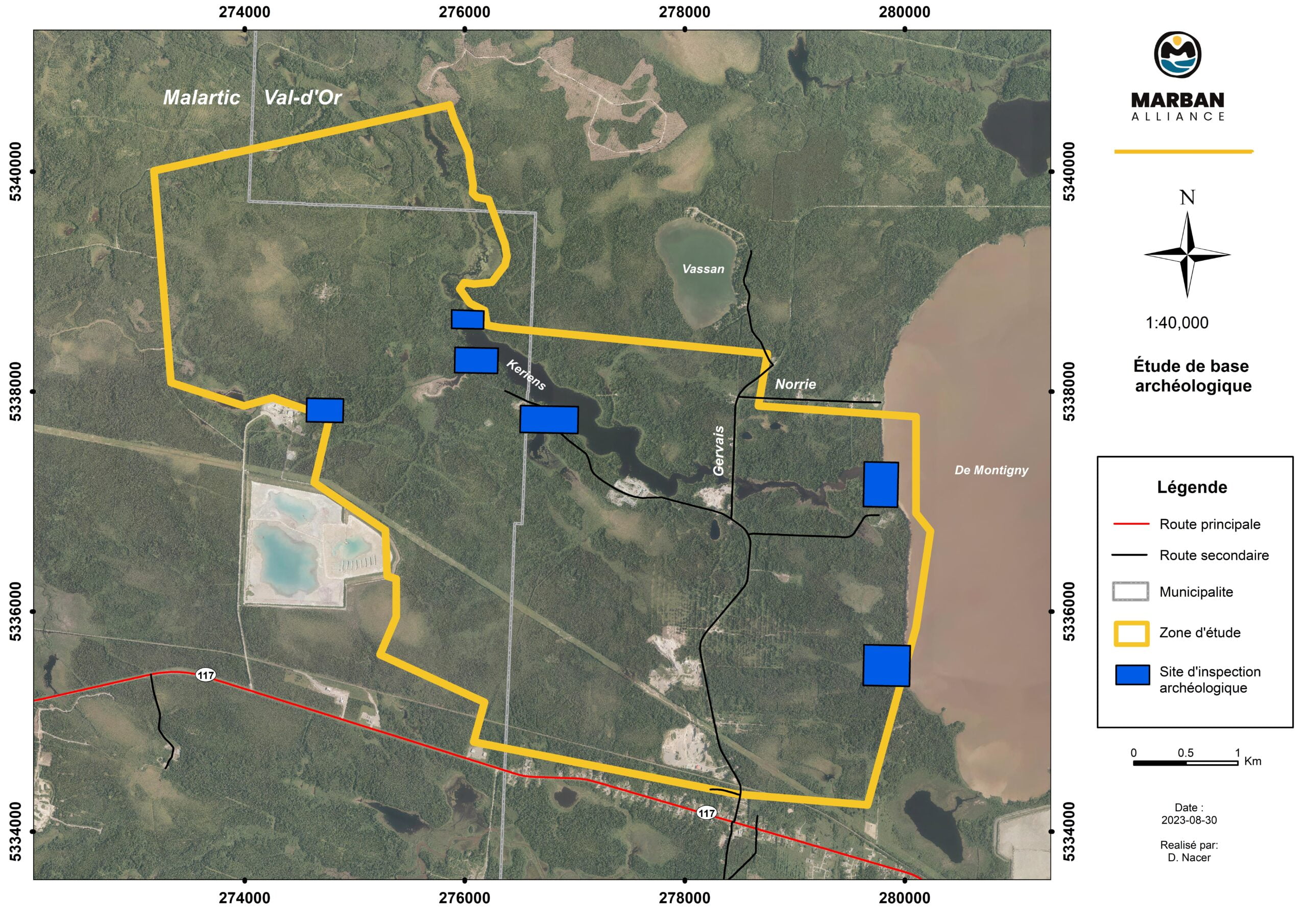
The Marban Alliance project is located in the municipalities of Val-d’Or (Dubuisson sector) and Malartic, some 15 km northwest of downtown Val-d’Or and approximately 1 km northwest of the Dubuisson sector urbanization perimeter.
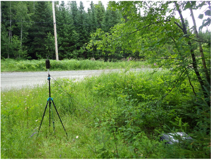
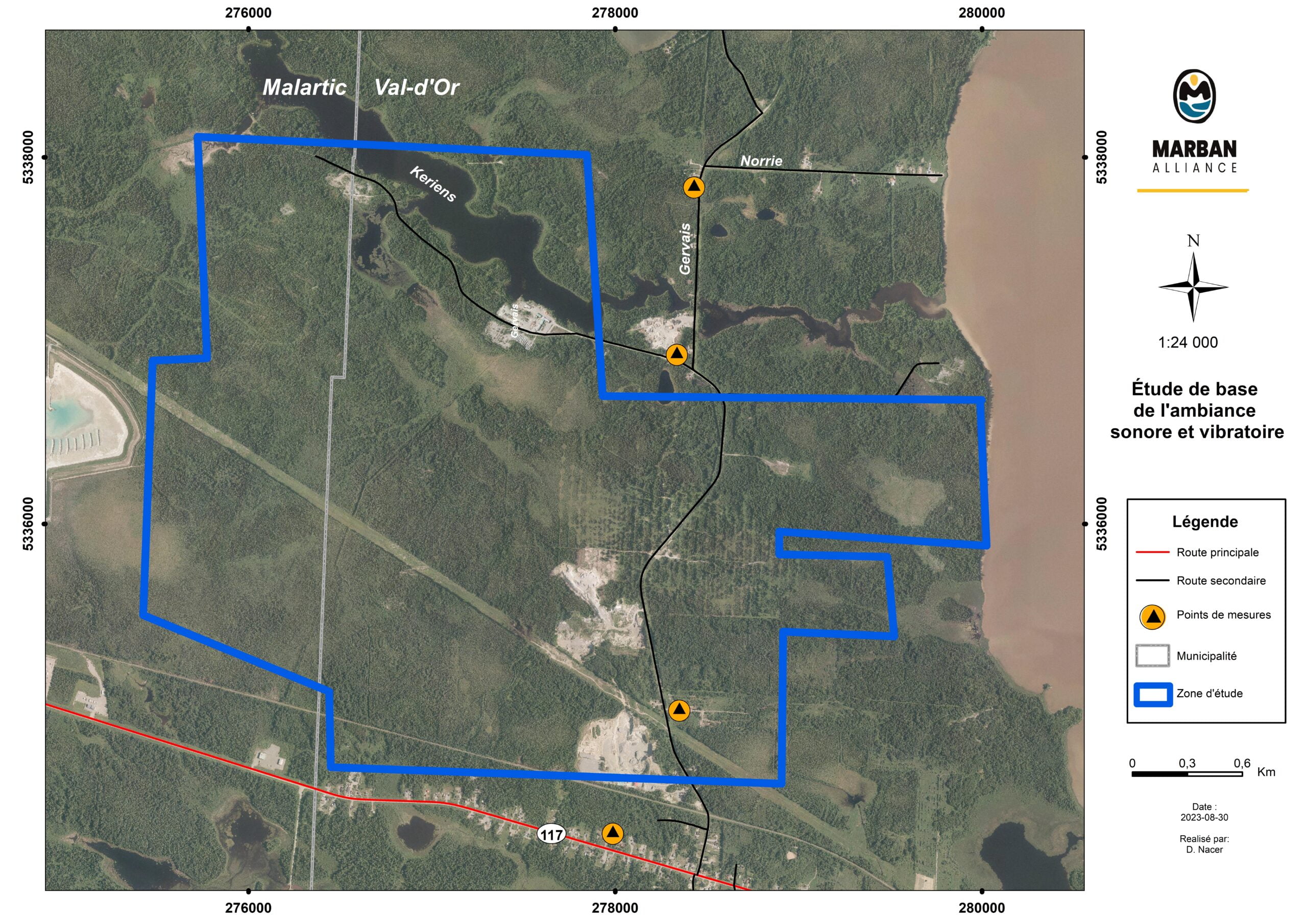
The baseline noise and vibration study describes current background noise and vibration levels in the project area. The main objectives of this study are to measure and record background noise and vibration in the target area, and to establish criteria applicable to the project based on the measured noise and vibration climate, in compliance with provincial and federal regulations.
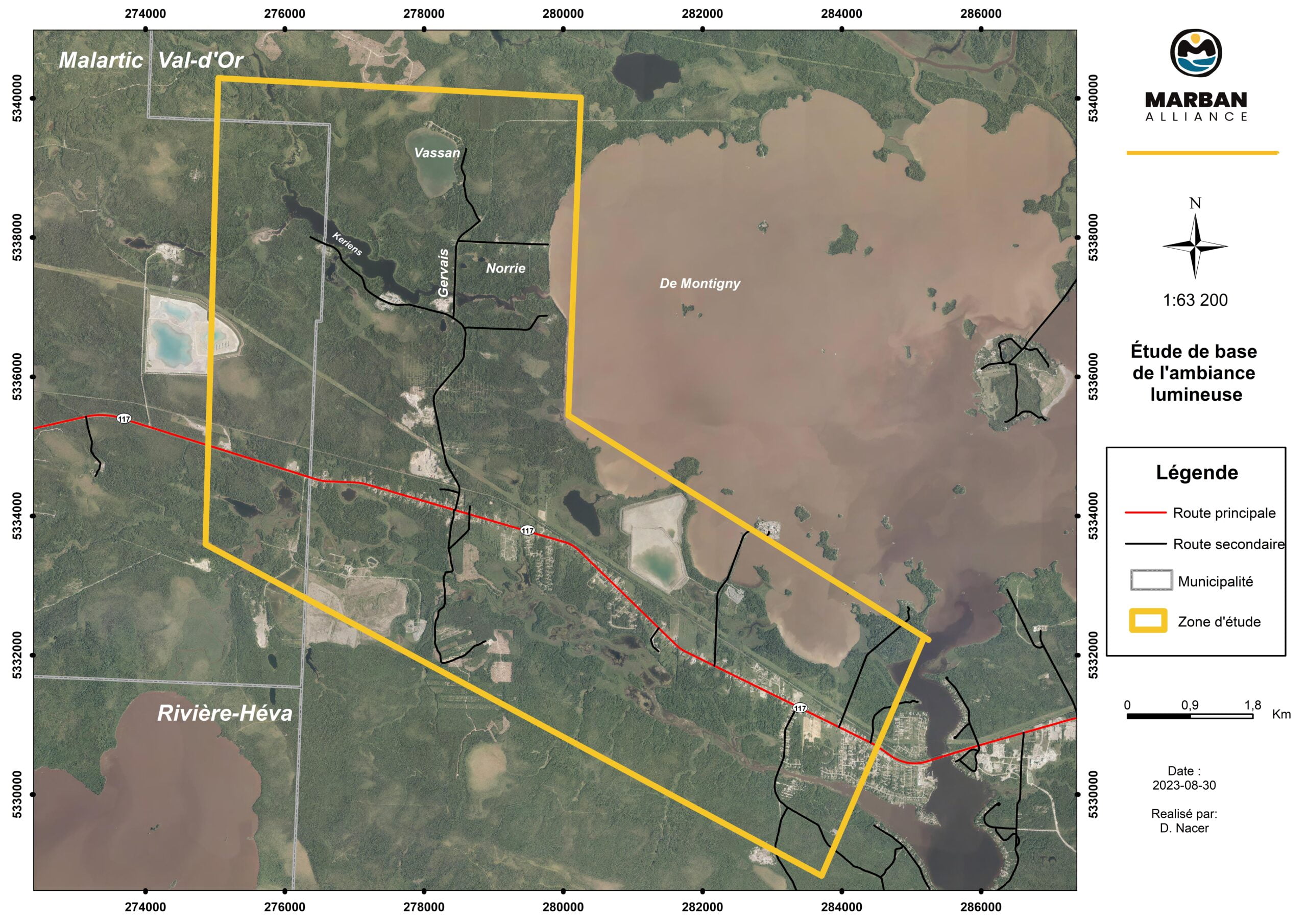
Ambient light studies are done to determine the existing baseline atmospheric light conditions within the vicinity of the Project to identify the potential light pollution from the Project.
The federal general guideline for an impact study requires that the following be analyzed and characterized:
Luminous ambience is increasingly the subject of interest due to the concerns associated with this issue by communities located on the periphery of major industrial projects, particularly when sensitive receptors are located close to and along bodies of water where visual barriers are less present.
The description of baseline conditions is then used to assess the changes associated with the project.
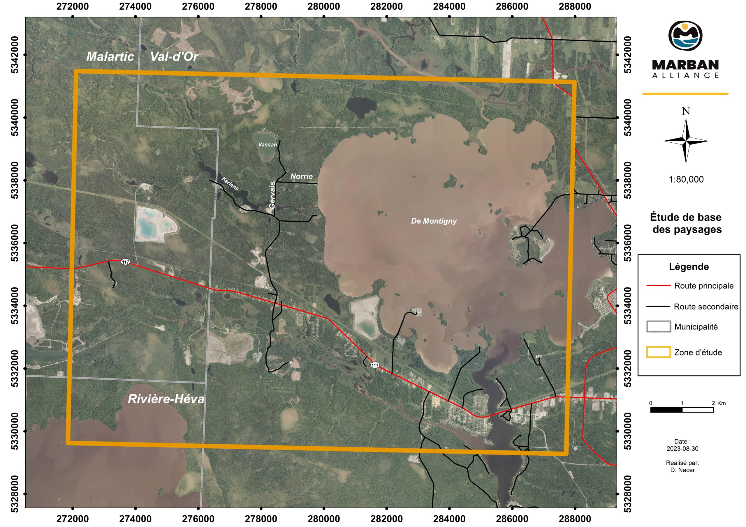
A landscape baseline study characterizes the existing landscape, view and visual challenges from locations surrounding the proposed project area.
This study presents the elements and visual ensembles of local or tourist interest in a photo documented report. The landscape protection is one of the issues to be considered during the development of the Marban Alliance project. The landscape baseline study is done according to the section 2.3.2 of the Directive pour la réalisation d’une étude d’impact sur l’environnement (MELCCFP).
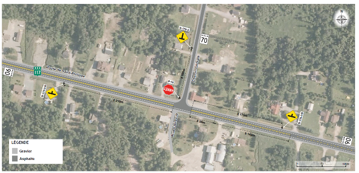
To carry out the studies required to describe the project’s insertion environment, the traffic and road safety current status must be established. To complete this baseline study, the road network overview is characterized, the average annual daily traffic flows and hourly vehicle flows is calculated by using MTQ data and field data.
The road safety indicators are also calculated by using MTQ’s database.
An analysis of traffic and road safety at the junction of Route 117 and Chemin Gervais is required to assess the impact of the Marban Alliance project on this component.